Overview
Each regional planning agency (including CRCOG) is required to demonstrate that their Regional Transportation Plan and Transportation Improvement Program (TIP) do not violate the federal Clean Air Act. This demonstration requires tests for several types of pollutants, for several different analysis years, and for several different analysis areas or districts as explained below. For reasons also described below, the State performs a statewide analysis, with all Plans and TIP projects in the state analyzed together.

Air Quality Analysis Districts
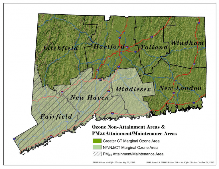
The federal air quality districts for ozone are shown in the figure to the left. For ozone analysis purposes, CRCOG is part of the Greater Connecticut district. The Greater Connecticut district includes other planning regions in addition to the Capitol Region. It uses county boundaries and includes the following counties: Hartford, Tolland, Litchfield, Windham, and New London.
Since the air quality districts overlap many regional planning districts, the emissions analysis must be coordinated to include the TIPs and transportation plans of several regions. The Connecticut Department of Transportation performs this coordination role. Each region submits its draft TIP and long range plan to the DOT. The DOT in turn combines the TIPs and the transportation plans for all appropriate regions to analyze the emissions impacts on each air quality district.

